
Walk The Line: A Wander on Angaston’s Railway Heritage Trail

A blue-sky day in Angaston, the crown of the Barossa Valley. The air is crisp and still; the cool of the morning has not yet been warmed by the spring sun. After two cups of tea and a cursory read of the weekend papers, I embark upon a little wander to stretch my weary body. With an elevation of 347m, Angaston is one of the highest points in the valley, yet the town is nestled in a sort of hollow, which made it one of the last places in Australia to be able to get good reception for digital television. The best place to take a photo of this cosy geography is unfortunately just near a private home on a hill that houses a rather unfriendly hell-hound who personally objects to strangers stopping outside his home to take photographs or pick snacks from a remarkably abundant roadside pear tree.


The town of Angaston: a brief introduction

Partial aerial view of Angaston, looking west towards Nuriootpa. Angaston is a town on the eastern side of the Barossa Valley in South Australia, 77 km northeast of Adelaide. Settled in 1842, it has a population of more than 2000. The main industries of the town are agriculture, tourism and mining. And wine. Oodles of wine. The credit for this photo I found on the internet is in the references.


And now for the walking trail…
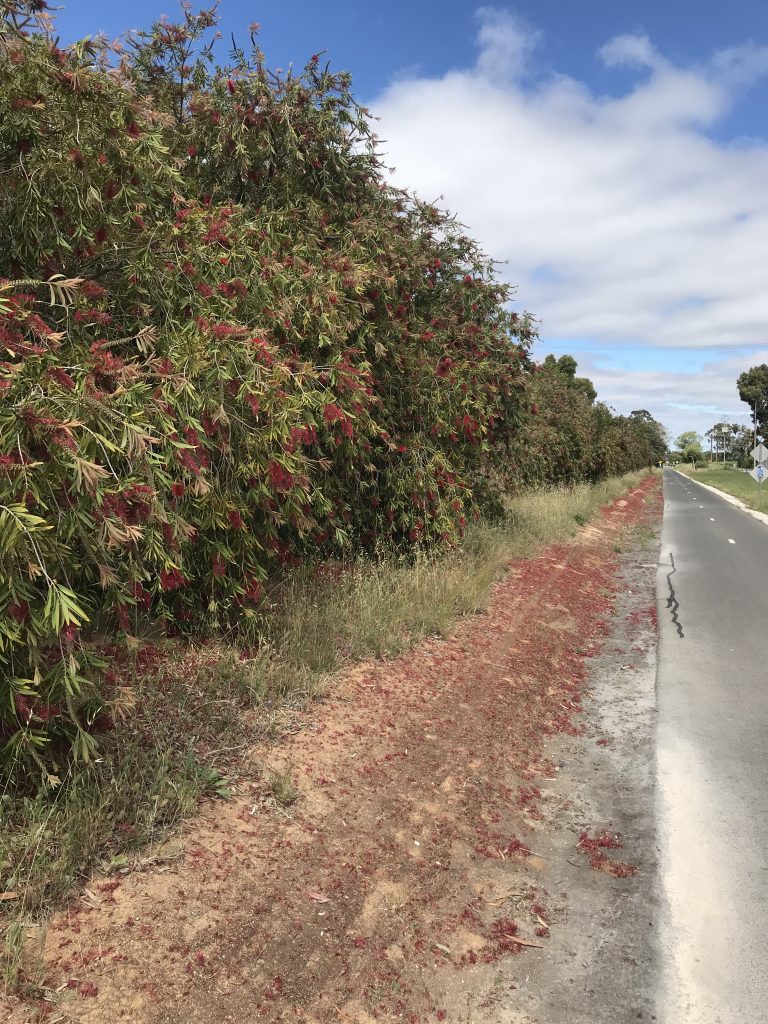
Just behind the grand old town hall on Washington Street is the entrance of a walking path and adventure playground; follow this track and it will eventually take you to Nuriootpa (7 kilometres) via the old railway track which has been repurposed as a recreational cycling and walking path.


The Angaston Station site has recently had a remarkable reinvention as a multi-purpose recreation area known as the Barossa Adventure Station. A 1km Mountain Bike Track overlooks the old railway yard and there are grassed areas- and a playground so popular on sunny days you have to line up to get a go on the equipment.


The path passes vineyards and wineries, private properties, native grasses and bushes, fruit and olive trees. I started at the Angaston end with my fleeting morning energy, which is quickly sapped from the hangover of my Friday chemo sessions. So I didn’t quite make it to Nuriootpa, although I have many times before on borrowed bicycle or when feeling my usual more-energetic self. I did a U-turn at Stockwell Road, rendering my walk a five-kilometre rather than 14-kilometre effort. Road crossings have been paved to resemble rails and sleepers – please exercise extreme caution at all road crossings- there are a lot of freight trucks crisscrossing the valley floor at any given time and the Stockwell Road crossing just in front of the Cement factory at Angaston is actually a freight route.


I retraced my steps; north-west toward my destination and south-east upon my return on this Saturday morning meander. When embarking upon any journey, it sometimes seems that returning to the starting point via the same route is counter-intuitive to the philosophy of having an adventure; however, retracing your steps in a different direction can give marvellous insight with a differing perspective. You see different things each way, and the observations made on any journey of course change your outlook a little; I for example whilst walking generally set my sights on my left side. I saw olive trees and neat rows of vines on the way, and reclining cows or the hay rolls dotted on the hills on my return.
A steady incline starts working the leg muscles as you pass the Brighton Cement factory; luckily the shade from high embankments and deep shady cuttings at the Angaston end provide some relief on a sunny day. There are information and map boards, metal sculptures and park benches for a little rest at regular intervals.
At Angaston the trail terminates on Washington St. Turn left then left again into Sturt St to access Murray Street shops and cafes. Plenty to do, see, and eat and drink there, too! If you make it all the way to Nuriootpa, the old Penfolds precinct across the road using the rail crossing as a guide also has some lovely places to eat and drink and recaffeinate. A walking and cycling track runs parallel to the Barossa Valley Way, so if you are up for it you can keep going until you get to Tanunda, around another seven kilometres. All flat ground and shaded, too.

George French Angas
Australia
25 April 1822 – 4 October 1886
Opening of the free chapel at Angaston, German Pass, February 28th, 1844
plate 6 from Description of the Barossa Range and its neighbourhood in South Australia
1849
lithograph, hand coloured with watercolour on paper
A Short History of the Old Railway Line


The Gawler to Angaston line was officially opened in 1911 with much fanfare and excitement. The Railway Authorities commissioned a special school train for the opening, which carried 1258 children. It was a long time coming- many studies since the formation of South Australia in the mid to late nineteenth century looked into building a rail line to the Barossa but it was always deemed too expensive. In those days, the ‘fruits of the Valley’ had to be transported to Adelaide via horse and waggon- a railway was much needed to deliver fresh produce.


A quick visit to the Local History room at the Barossa Library in Nuriootpa led me to some histories of the Angaston line. I read of the celebrations commemorating the completion of the end of the line at Angaston- what an exciting day it must have been! The Governor of South Australia (his name is not recorded in this book- a quick look on Wikipedia tells me Admiral Sir Day Bosanquet was the Governor from 1909-1914) arrived to around 6000 excited onlookers. The vice regal train had been decorated by a local nurseryman: a large “A” had been formed using cornflowers and king violets on a background of ivy leaves and encircled with white everlastings.
As he stepped off the train onto the Angaston platform, various bands played the national anthem- God Save the King– , then the train backed up a little and he stood at the end of the line to give a short speech. After declaring the line open, he called upon the crowd to give three cheers, to which they happily responded. Afterwards, officials and spectators made their way to the Angas Recreation Park (now better known as ‘the oval’) for luncheon and activities. Many more speeches were given, and the entertainment was fireworks, kite flying, a Punch and Judy show and music. The children were all given a ‘box of provisions’ (meaning snacks, I guess!) and for hot drinks; a Mr T Ludlow was kept busy boiling water with the aid of six wood-fired coppers. The activities at the new adventure park over a century later are not much different- children playing, lots of picnic food and music- not so many speeches or town bands nowadays.
The coming of rail to Angaston in 1911 brought a new prosperity to the town, as Adelaide people came and stayed a night or two at the local hotels. Residents renovated their shops and could afford new builds. The rail provided means of transporting cases of fresh and dried fruit and casks of wine to the city. Angaston residents could now easily get to Adelaide to visit the zoo, cinema or museum. As well as passengers, parcels and freight goods came by train and large items were collected by a horse and dray to be delivered to the Murray Street businesses. The Royal Mail came up with the passenger trains in the evenings and two postal clerks would wheel a wooden cart with large wooden spoked wheels to the railway station to collect the canvas bags of mail, to be taken to the post office for sorting.

In 1917 the line was extended further north east from Nuriootpa to Truro and later a further branch off this to Penrice Quarry about 6km from Nuriootpa.’Stonie’ trains used the line to ferry soda products from Penrice quarry to Osborne until 2013. I remember waiting patiently as they chugged slowly over the crossings. I kept myself amused by counting the carriages.
Regular commuter passenger services were withdrawn in 1968 and the Barossa Wine Train stopped in 2003.
In 2010, the track between Nuriootpa and Angaston was removed and the high standard rail trail walking and cycling track was constructed. In 2020 the section of the train line between Tanunda and Nuriootpa was removed to build a giant roundabout so it looks like that is ‘the end of the line’ for rail services beyond Gawler.

Angaston is a beautiful town to walk around- I feel very lucky to live here. Not so much for cycling. I am not fit enough and there are too many hills. The Tour Down Under comes here in the summer- I am sure all these inclines excite professional cyclists and in the old days, small children with go-karts. I’ll stick to the walking trail thank you- there are cafes in all of the towns to help me recover from any effort I make to stay active and enjoy the sunshine on my face.
References:
Photo of Angaston: https://www.homely.com.au/homes/lot-612-lindsay-street-angaston-sa-5353/6283756#gallery
Hausler, Anne, et al. The Barossa: Federation to the Fifties: the Twentieth Century 1901-1950s. Barossa Valley Archives and Historical Trust Inc., 2017. (Barry Chinner wrote the Angaston section of this book- he let me read all his notes!)
Sallis, Roger. Railways in the Barossa Valley. Roger Sallis, 2000.

Leave a Reply